Contents
Index
Print Plan to PDF File
This option is found in the File Menu and will compose a survey plan from the data in the joined parcels for a selected plan.
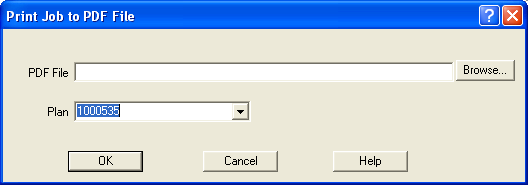
PDF File
Browse to a location on your computer where the PDF file is to be saved and save the file with an appropriate name.
Plan
Select the Plan to be printed to PDF from the drop down menu.
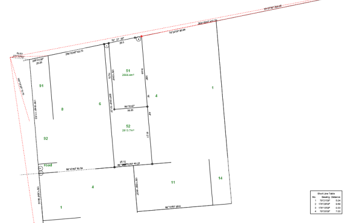
The joined parcels for the selected plan will then be printed to the PDF file.
The PDF file will show all boundary lines, connections to control and any other connections that
were entered during data entry for the parcels that were entered and joined for that particular plan.
The Lot number and area for each of the parcels on the selected plan will be displayed in
the centre of the parcel in the PDF file.
Bearings and distances for each of the lines and connections for each parcel on the selected plan will
also be shown in the PDF file.
A Short Line Table will be generated for any parcel lines that are too short to display the bearing and distance.